NAEVA Geophysics, Inc.
  • Home
  • Services
    • Services
    • Electromagnetics
    • Ground Penetrating Radar
    • Magnetics
    • Advanced Classification
    • Utility Locating
    • Seismic Refraction
  • About Us
  • News
  • Employment
  • Contact Us
  • More
    • Home
    • Services
      • Services
      • Electromagnetics
      • Ground Penetrating Radar
      • Magnetics
      • Advanced Classification
      • Utility Locating
      • Seismic Refraction
    • About Us
    • News
    • Employment
    • Contact Us
  • Home
  • Services
  • About Us
  • News
  • Employment
  • Contact Us

Magnetics

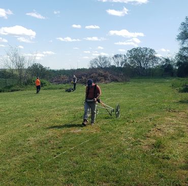
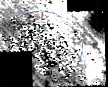
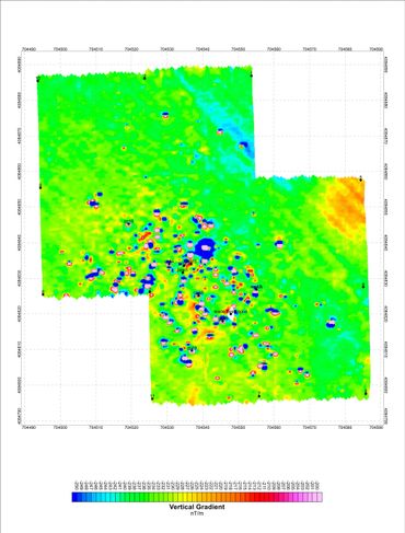
The magnetic method measures variations in the Earth’s magnetic field. Surveys are typically conducted by measuring the magnetic field strength along survey transects. Compared with other geophysical methods, magnetics can offer an advantage in ease of deployment in rough terrain, and in areas where vegetation may obstruct larger instruments, such as electromagnetic coils. Depending on the specific application, sophisticated magnetic modeling programs can be utilized to characterize the source of the magnetic anomaly as to size, mass, depth, and possibly orientation 


Applications of Magnetics include:

  • Identifying unexploded ordnance (UXO)
  • Locating underground storage tanks (UST)
  • Locating buried drums
  • Delineating landfill perimeters
  • Identifying locations of historic structures
  • Identifying geologic bedrock features such as mafic dikes or geologic contacts
  • Delineating areas of ferromagnetic debris

Copyright © 2022 NAEVA Geophysics, Inc. - All Rights Reserved.

  • About Us
  • News
  • Employment
  • Contact Us
  • Employee

This website uses cookies.

We use cookies to analyze website traffic and optimize your website experience. By accepting our use of cookies, your data will be aggregated with all other user data.

Accept